Patrick Alan Miller, Ph.D., FASLA, FCELA — Professor of Landscape Architecture based in Blacksburg, Virginia and Nye , Montana
Claytor Lake Scenery Management Study
Principle Investigator:
Dr. Patrick Miller, FASLA, FCELA
Professor, Landscape Architecture
Project Team:
Dr. Song Liu, Visiting Scholar, Tongji University, Shanghai, China
Elizabeth Gilboy, Director, Community Design Assistance Center (CDAC)
Kim Steika, Landscape Architecture Project Coordinator, CDAC
Shamsul Abubakar, Graduate Student, Architecture & Design Research
Christine Calorusso, Graduate Student, Environmental Design & Planning
Melissa Philen, Graduate Student, Environmental Design & Planning
Yining Xu, Graduate Student, Landscape Architecture
Zheng Chen, Graduate Student, Architecture & Design Research
Project Consultants:
Seth Peery,
Senior GIS Architect, Enterprise GIS Research & Development Administration, Virginia Tech
Peter Sforza,
Research Associate, Geography, Virginia Tech
Appalachian Power Company
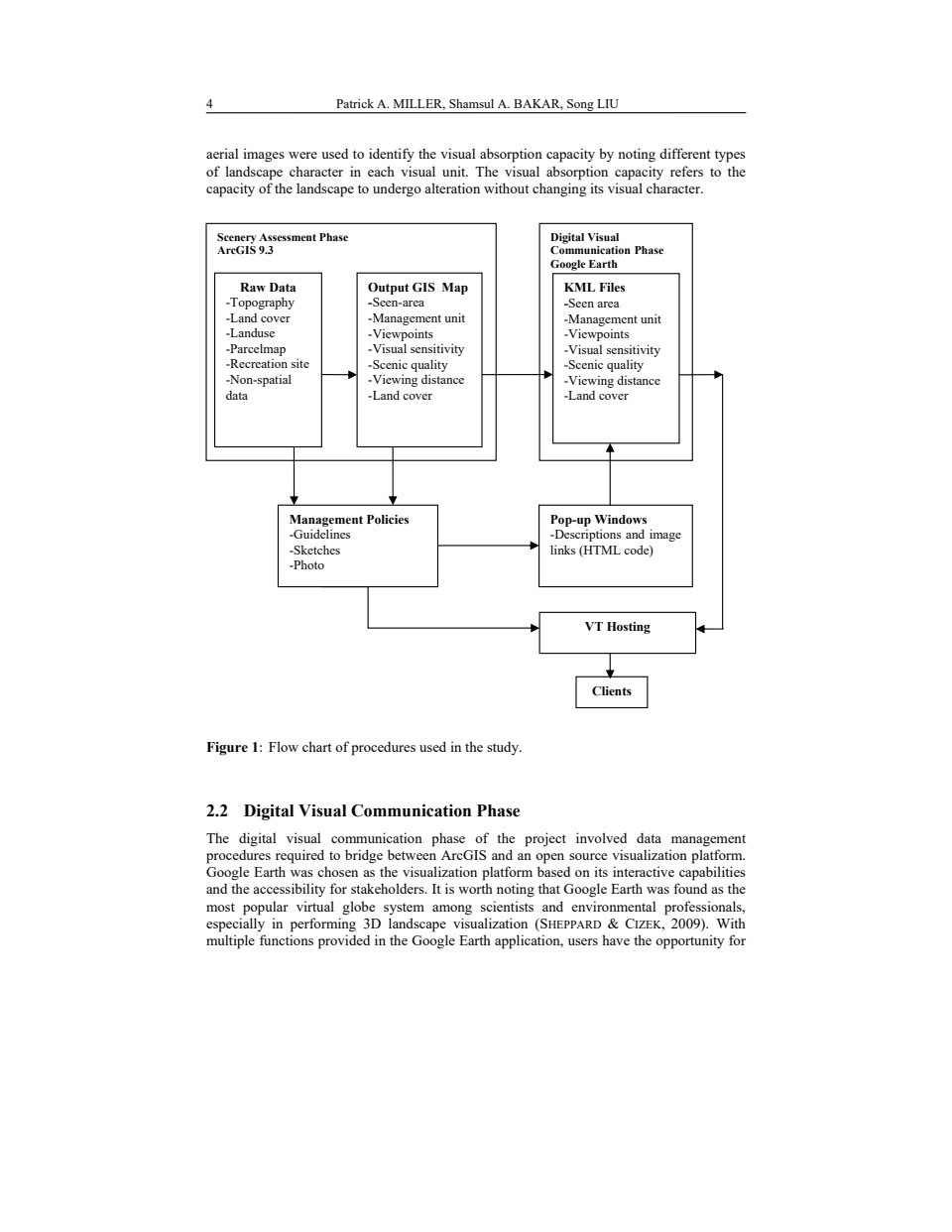
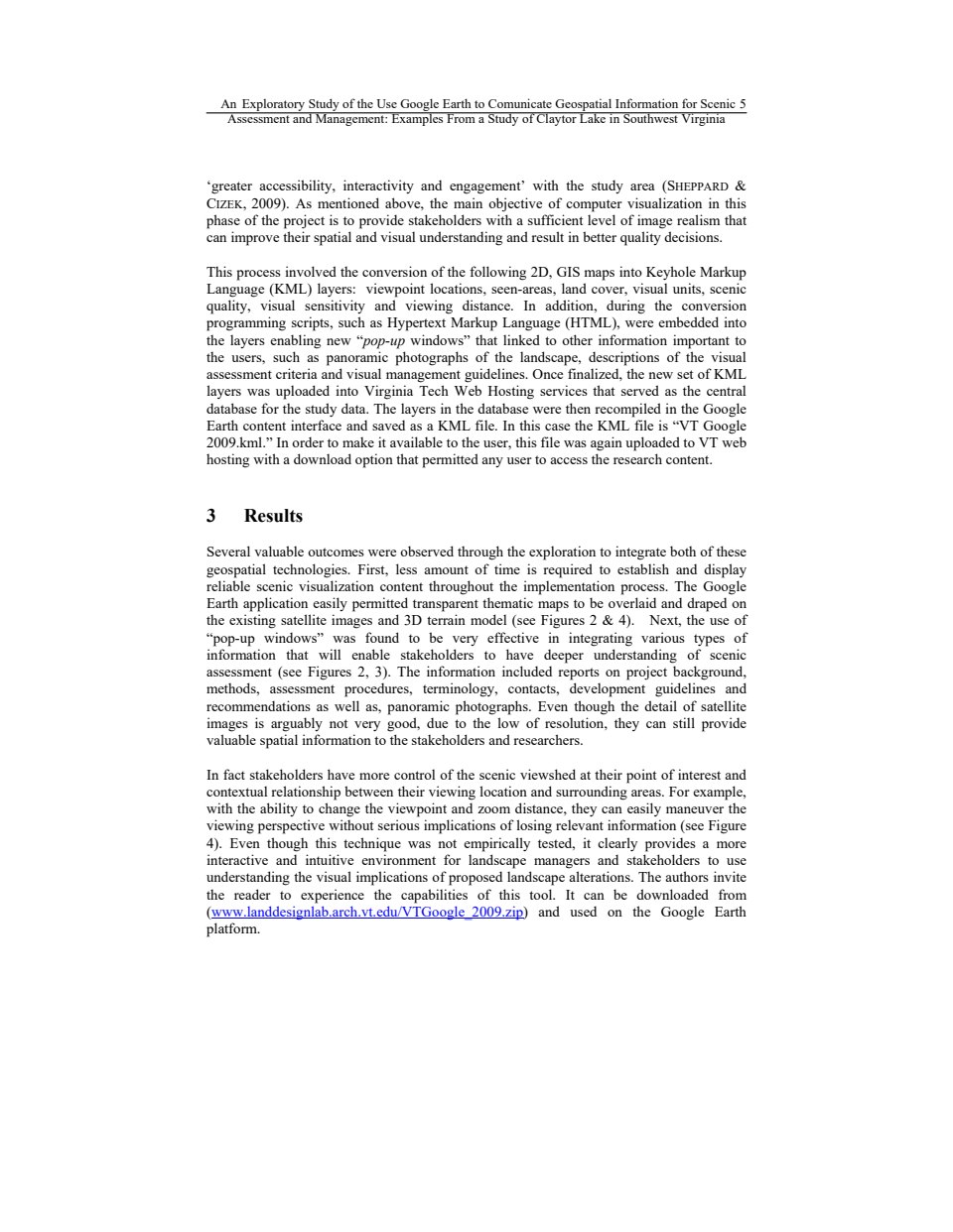
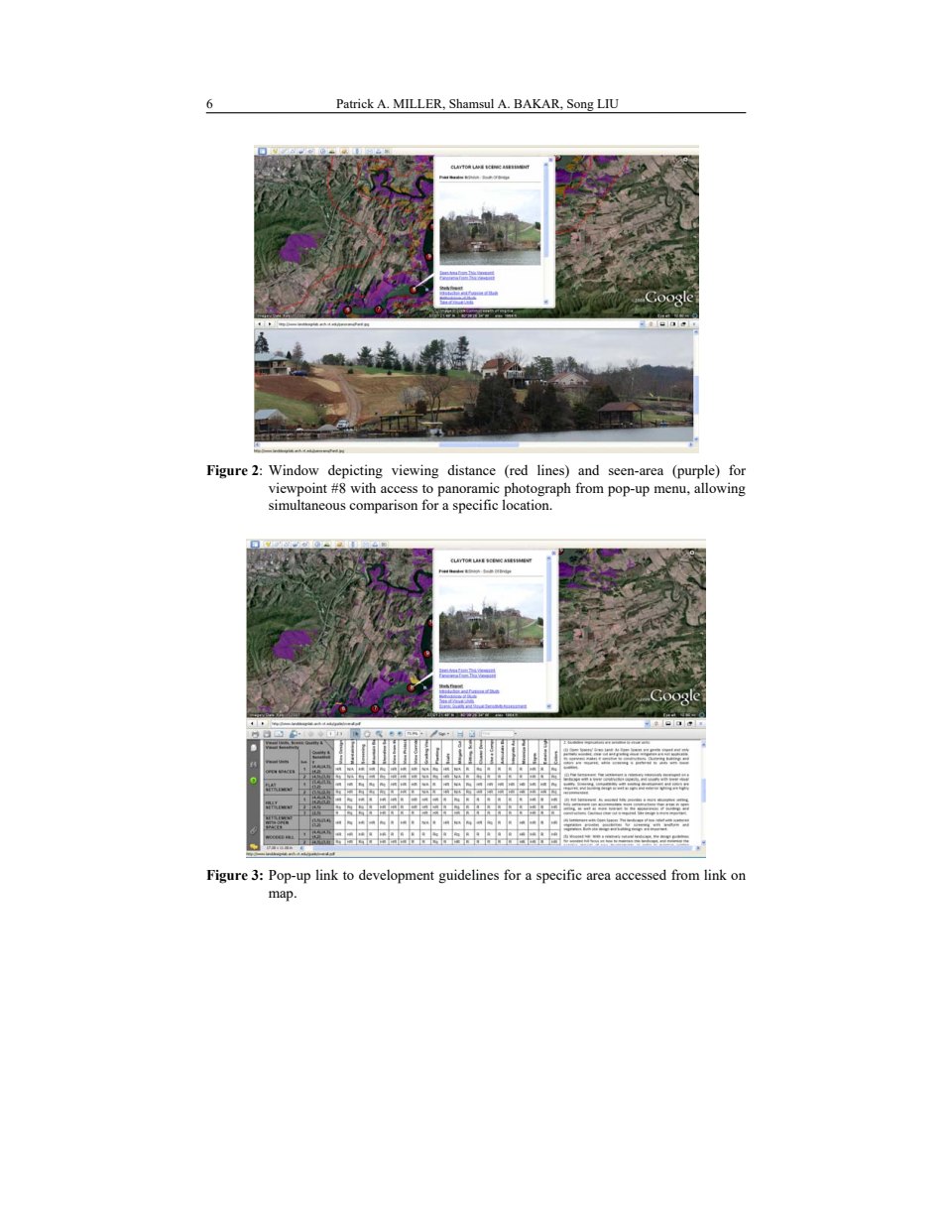
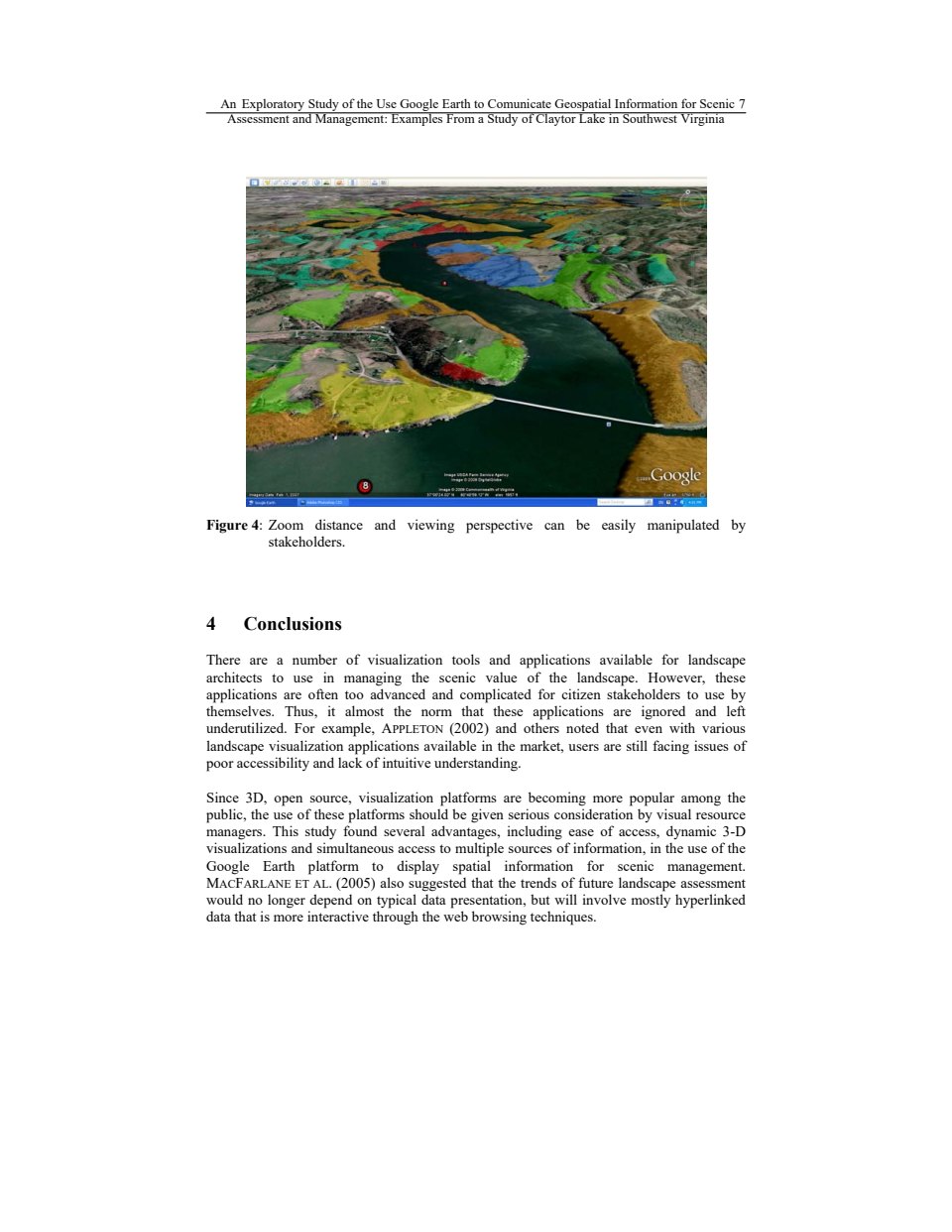
Landscape architects have long helped people identify important visual characteristics of cherished landscapes. However, visual studies, in the form of inventory maps and reports, are often not easily understood, nor are they accessible to citizens. This project used Google Earth to communicate geospatial information for the Scenic Assessment and Management of Claytor Lake in Southwest Virginia, making it possible for anyone with a computer and an Internet connection to view 3-dimensional scenic inventory maps from multiple viewpoints, panoramic landscape photographs and design guidelines.


The Greening of Cities Next
Hoover Ridge Park: Visioning a Rural Community